Northern California is seeing two or three times more rain than normal. So why is Southern California so dry?

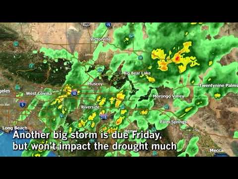
Despite a rainstorm set to hit the Southland, the region faces an unprecedented lack of precipitation, recording only 60% of average rainfall this month.
As the state enters its sixth year of drought, Northern California is seeing some significant relief thanks to a series of powerful storms, while Southern California remains mired in record dry conditions.
Despite a rainstorm set to hit the Southland this week, the region continues to face an unprecedented lack of precipitation, recording only 60% of average rainfall this month. By contrast, communities from the Bay Area north to the Oregon border have recorded 200% to 300% of the average this month, according to the National Weather Service.
It’s a pattern Californians saw last winter, when the much-hyped El Niño phenomenon was expected to soak Southern California but instead steered north, blanketing the northern Sierra Nevada in snow and leaving Angelenos and their neighbors in the dust.
“We can only hope as the winter progresses we’ll get the rains to go farther south,” said Reginald Kennedy, a National Weather Service hydrologist. “Nothing in the climate forecast wants to tip its hat.”
Rain and snow in Northern California are considered essential to easing the drought because the state’s major networks of dams and reservoirs are located there, providing water to many other parts of the state. While rain in Southern California is also important, much of it flows into storm drains and into the ocean.
Since Oct. 1, the start of the water year — which forecasters use to measure annual precipitation — cities and mountain communities from the Bay Area to the Oregon border have been drenched by an atmospheric river of tropical storms. It’s rained more than 18 inches this month in Gasquet, a rural community in Del Norte County, and 12 inches in Crescent City, Kennedy said.
The rainfall was enough that the U.S. Drought Monitor considered the northwest corner of California, or about 7% of the state, to be in normal condition instead of “abnormally dry” or worse. That much of California has not been considered normal since March 2013.
Last year the El Niño story was flipped on its head from what was expected.
— Doug Carlson, spokesman, Dept. of Water Resources
The Drought Monitor, however, warned that much more rain and snow will be needed in the winter “to undo the far-reaching impacts of the ongoing ...drought.”
“It’s a nice start. We’re pleased to see that some of the reservoirs are holding their own in the northern half of the state,” added Doug Carlson, a spokesman with the state Department of Water Resources. “But if you get to the southern part of the San Joaquin Valley, they’re only at 7%.”
More rain would help California’s water supply issues. Over the last two years, Californians significantly reduced water consumption by ripping out lawns, buying water-efficient appliances and taking shorter showers, among other things. But in recent months, water conservation efforts have slipped as the state eased water restrictions.
Statewide, people in cities and towns cut their water use by just 17.7% in August compared with the same month in 2013. In August 2015, Californians reduced their consumption by 27%, beating the target of a 25% reduction set by Gov. Jerry Brown.
More storms are forecast for the northern half of the state with only hours-long breaks in between through the beginning of November, Kennedy said.
Government agencies that rely on the summer snowmelt and this season’s rains for their water could get up to 60% of what they’re requesting, a huge leap from the 5% that was projected at this time last year, Carlson said.
“That’s good, but I think we have to be conservative that our long-term forecast is very, very shaky,” he said. “Last year the El Niño story was flipped on its head from what was expected. A lot of rain was expected in the south but you didn’t get it.”
As a result of the recent storms, the California Department of Forestry and Fire Protection began shrinking its firefighting force in the north, an agency spokesman said Monday.
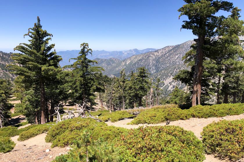
Crews remained on full alert in Southern California, however, as high temperatures, strong winds and low humidity kept the San Gabriel Mountains under red-flag conditions for much of last week. Southland brush fires are often driven by hot Santa Ana winds, which usually continue into November and December.
Though a relatively significant storm is expected across Southern California through Friday, the impact on the overall drought picture will be negligible, experts said.
A quarter to three-quarters of an inch of rain is expected to fall across Los Angeles and Ventura counties, said National Weather Service meteorologist Dave Bruno. Up to an inch is predicted in the Los Angeles County mountains and possibly as much as 2 inches in Ventura County mountains.
“We are still uncertain as to how much rain is going to fall across Los Angeles County in particular,” Bruno said. “We do think there’s a potential for moderate to heavy rain — certainly a pretty good storm for October.”
If there is heavy, intense rain, there is a chance for a flash-flood watch for burn areas, Bruno said.
“That’s going to be the main thing we’re concerned about with this system,” Bruno said. “If that really heavy rain gets into L.A. County, that could be an issue. We’re definitely going to watch that closely.”
For breaking California news, follow @JosephSerna on Twitter.
Times staff writer Brittny Mejia contributed to this report.
ALSO
Why Gov. Jerry Brown is staking so much on Proposition 57 and prison sentences
California’s voter registration deadline has passed, but not for new U.S. citizens
Tour bus crash that killed 13 underscores gaps in safety regulations
More to Read
Start your day right
Sign up for Essential California for news, features and recommendations from the L.A. Times and beyond in your inbox six days a week.
You may occasionally receive promotional content from the Los Angeles Times.


